Early Fall Nor'easter Hits US East Coast with Heavy Rain and High Winds
Based on reporting by The Guardian
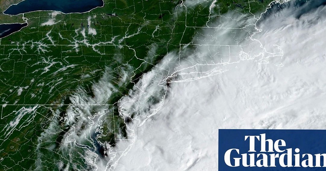
By Friday morning the storm was already lashing coastal areas of Rhode Island, Massachusetts, Connecticut, and New York's Long Island. The National Weather Service's Boston office warned in a post on X that strong winds, rough seas, and prolonged steady rain were expected through the weekend, with rain potentially lasting until Monday. Beach erosion, coastal flooding, downed limbs, and power outages were cited as the main concerns.
A "significant" nor'easter — the first of the fall season — began striking New England on Friday, September 25, bringing heavy rain and high winds that threatened to disrupt weekend plans for up to 40 million people across multiple US states.
Inland areas were also preparing for the storm's arrival, which carries the potential for hurricane-force winds, though forecasters noted uncertainty about its precise track. AccuWeather projected winds of 40–60 mph along the coast from New Jersey to Maine starting late Friday, with gusts of up to 80 mph in and around Montauk, New York.
AccuWeather meteorologist Elizabeth Danco said in a statement that the nor'easter had strengthened over the Atlantic and was expected to stay closer to the shoreline, bringing more rain inland but, more importantly, stronger winds near the coast. She added that the region had seen heavy rainfall in recent weeks, making it especially vulnerable to falling trees and flooding.
Travelers were warned to expect significant flight cancellations, delays, and difficult driving conditions, with the worst flooding and beach erosion anticipated near the coastline. Up to 8 inches of rain were forecast for parts of south-eastern Massachusetts, with up to 2 inches projected for Boston on Friday into Saturday and the same for New York City a day later. High wind warnings were already in place for Boston and surrounding areas Friday morning.
The Weather Channel advised residents of New York City and especially Boston to remain weather-aware and prepare as they would for a tropical storm. It also noted that while nor'easters are more commonly associated with late fall and winter snow and ice, the atmospheric criteria for one are met more often earlier in the season than many people expect.
Three Pacific Hurricanes Also Active
At the same time, three separate hurricanes — Nolo, Odalys, and Polo — were churning in the Pacific Ocean, amid what forecasters described as a record-setting El Niño continuing to amplify severe weather events globally. Hurricane Nolo was threatening Hawaii and was expected to pass approximately 80 miles south of the Big Island as a major category 3 storm early Saturday. While not forecast to make landfall, AccuWeather's hurricane experts warned Nolo would bring five days of torrential rain through Monday, along with catastrophic flooding and mudslides.
Hurricane Polo, which rapidly intensified from a tropical storm to a category 5 hurricane earlier in the week, was located about 250 miles south-south-west of the Jalisco coast of Mexico on Friday. The National Hurricane Center in Miami said its 160 mph winds were likely to cause life-threatening surf, rip currents, and coastal flooding in the region. Polo was forecast to curve and make landfall somewhere in Baja California on Sunday night or Monday morning as a significantly weakened hurricane. Category 4 Hurricane Odalys was projected to remain at sea with little to no impact on land.
El Niño Reshaping Both Pacific and Atlantic Seasons
The ongoing El Niño has contributed to 18 named storms in the Pacific basin this season, while producing the opposite effect in the Atlantic — where, for the first time since 1914, no hurricanes had formed by September 21. Both the Pacific and Atlantic hurricane seasons run through November 30.